
South Howe
A team from the University of Bradford, Orkney College (UHI) and City University New York cleaned, recorded and sampled three sites including the Mound of Brough (HY 3727 3037) from 23 June–14 July 2010 as part of the ‘Orkney – Gateway to the Atlantic Project’. The project aims to investigate and record coastal sites in Rousay, Egilsay and Wyre which are threatened by rising sea levels and coastal erosion.
The man-made mound at ‘Brough’, also known as South Howe, on the SW shore of Rousay contains an eroding Iron Age broch and houses. These structures seem to be overlain by Late Norse buildings which in turn are overlain by 19th-century middens. This broch is only a few hundred metres away from the Broch of Midhowe (HY33SE 2). Coastal erosion has exposed the remains of a settlement mound that is surmounted by the ruins of the farm of Brough.

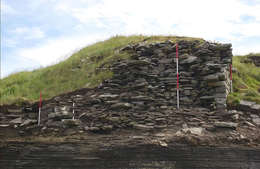
Laser scanning of the eroding broch known as South Howe, adjacent to broch farm in Rousay. The flat slabs in the foreground are bedrock, the highest part of the mound on the left is the broch tower
The active area of erosion extends for at least c70m along the low cliff face. In the centre of the eroding area are the remains of walling which appears to be the outer wall and entrance passage of a broch. This wall survives to a height of 2.5m and varies in width from 4.2m at its base to just under 3m at its highest point. Erosion to the W of this structure appears to be recent, with a cove-like zone extending 2m inland. This zone contained orthostats and flagging. A second zone of active erosion appears c20m to the E. Examination of this area revealed a number of walls; their construction strongly suggests that these remains represent a later phase of settlement, probably dating to the later medieval or early
post-medieval period.
Cleaning and sampling of the erosion face of the broch and associated settlement at South Howe - the broch tower is to the right of this picture.
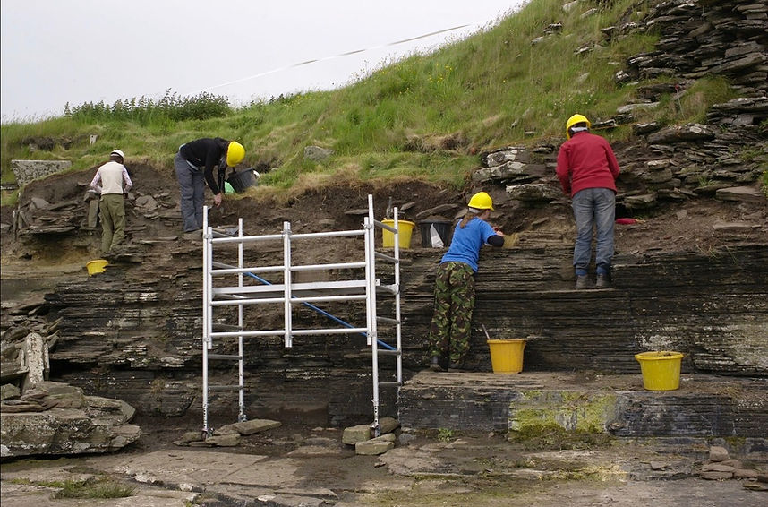
The aim of the 2010 season at South Howe was the characterisation and examination of the potential of the surviving archaeology by tapestry excavation of the cliff exposure. The large expanse of exposed wall core that forms the apex of the visible mound was not cleaned and was left in situ in order to maintain the stability of the wall. Turf and slippage was removed to reveal the outer wall face and the exposed wall core.
The main wall of the broch tower at South Howe neatly half sectioned by coastal erosion. Over half of this broch and surrounding village has been lost to coastal erosion without record.
To the E of this truncated wall a wall face ran N; this wall face turned at 90° into a second wall that appeared to run W into the mound and form the inner wall of a broch-like roundhouse. The N-oriented face is interpreted as the W side of an entrance passage. The in situ remains of a broken lintel stub projected from this wall. Midden containing 19th-century pottery, probably originating from the farm of Brough at the summit of the mound, appeared to seal the interior of the broch.
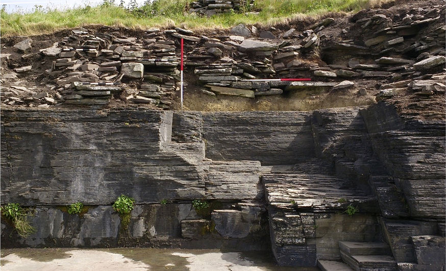
The eroding Iron Age village surrounding the broch tower at South Howe, bedrock below and buildings above. The red-and-white poles are 1 metre long.
The broch seems to have suffered from one or more severe erosion events and this material may represent re-deposition from in situ deposits at the top of the mound. This area was not excavated and requires further investigation to resolve the depositional sequence. The elevations of the eroding cliff sections were photographically recorded, with geo-referenced markers placed in each frame.